Satellite Image Analysis for Planetary Mapping: A Strategic Use Case for Presear Softwares Pvt. Ltd.
Head (AI Cloud Infrastructure), Presear Softwares PVT LTD
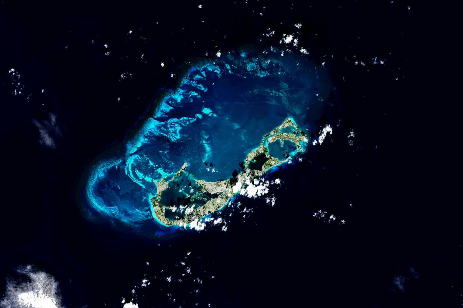
Planetary exploration has entered an era where data volumes have skyrocketed, mission timelines have become more ambitious, and the demand for rapid, accurate scientific insights has intensified. Whether it is the Moon, Mars, Venus, or distant icy moons, modern space missions rely heavily on satellite imagery for mapping, terrain analysis, monitoring planetary features, and identifying potential sites for research or landing. However, the traditional workflow for satellite image analysis is slow, manual, and error-prone—often leading to delayed mission decisions, missed anomalies, and significant scientific opportunity costs.
Presear Softwares Pvt. Ltd. is uniquely positioned to address these challenges through its advanced AI-driven geospatial analytics solutions, real-time image processing pipelines, and automated planetary mapping frameworks. By integrating cutting-edge machine learning, computer vision, and cloud-scaled data engineering, Presear enables space agencies and research teams to accelerate planetary mapping workflows with unprecedented speed, accuracy, and consistency.
This article explores how Presear’s technology transforms the domain of Satellite Image Analysis for Planetary Mapping, the pain points solved, the beneficiaries, and how the company’s innovation aligns with global scientific and commercial space exploration missions.
The Core Pain Point: Manual Mapping Delays and Missed Anomalies
Planetary mapping involves stitching, analyzing, and interpreting terabytes of satellite images captured by orbiters, rovers, and landers. Traditionally, this process has depended on manual inspection and semi-automated GIS techniques. While these methods offer precision, they come with major limitations:
1. Excessive Processing Time
Planetary missions capture thousands of high-resolution images daily. Manual processing often takes weeks or months.
2. Undetected Anomalies
Human analysts may overlook small but mission-critical features such as:
Volcanic vents
Water-formed channels
Subsurface ice indicators
Unusual rock formations
Entry or crash site traces
Missing such anomalies can affect scientific conclusions, mission safety, and resource planning.
3. Inconsistent Mapping Quality
Different teams produce different levels of accuracy and annotation standards, leading to inconsistent planetary maps.
4. High Operational Costs
Time-intensive workflows require large research teams, inflating project budgets.
5. Lack of Real-Time Insights
In fast-moving missions—such as lunar landing attempts—real-time decision-making becomes impossible with manual workflows.
Presear Softwares Pvt. Ltd. solves all these challenges using intelligent automation.
Beneficiaries of Presear’s Planetary Mapping Solutions
1. NASA
For missions like Artemis, Mars Reconnaissance Orbiter (MRO), and Europa Clipper, real-time surface insights are crucial.
2. ISRO
Presear’s solutions support missions such as:
Chandrayaan lunar mapping
Mangalyaan Mars mission
Upcoming Venus and human-spaceflight programs
3. SpaceX
Commercial missions need rapid analysis of planetary terrains for:
Starship landing site selection
ISRU (In-Situ Resource Utilization) studies
Mars colonization planning
4. International Planetary Research Teams
Universities, space research labs, and observatories require scalable mapping tools for continuous research.
5. Private Aerospace Startups
Lunar mining, asteroid exploration, and satellite analytics companies benefit from automated geospatial intelligence.
How Presear Softwares Pvt. Ltd. Transforms Planetary Mapping
Presear leverages its strong software engineering, geospatial intelligence expertise, and next-generation AI architecture to create an ecosystem that fully automates end-to-end satellite image analysis.
1. AI-Powered Satellite Image Processing Pipeline
Presear builds fully automated pipelines that transform raw satellite data into structured, usable maps.
Key Capabilities:
a. Image Denoising & Enhancement
Removes atmospheric noise, low-light distortions, and transmission artifacts.
b. Image Stitching & Orthorectification
Combines thousands of overlapping images into seamless, accurately aligned planetary surface maps.
c. Super-Resolution Reconstruction
Enhances image resolution up to 4× using deep learning.
d. Terrain Reconstruction
Creates:
DEMs (Digital Elevation Models)
3D surface models
Slope and gradient maps
These are vital for landing site analysis and rover navigation.
2. Automated Feature Detection Using Computer Vision
Presear’s AI models detect planetary features with accuracy superior to manual tagging.
Identifiable Features Include:
Craters
Lava flows & volcanic structures
River-like channels
Ridge lines and fault zones
Ice deposits
Sand dunes
Frozen oceans
Meteorite impact basins
Thermal anomalies
The system continuously learns from new datasets, ensuring up-to-date planetary intelligence.
3. Real-Time Landing Site Analysis
Presear’s AI platform can evaluate potential landing zones based on:
Surface smoothness
Rock density
Slope angles
Shadow mapping
Radiation exposure estimation
Proximity to scientific targets
This drastically reduces decision-making time for lunar and Mars missions.
4. Anomaly Detection for Scientific Discoveries
One of the biggest advantages of AI is its ability to detect features that humans may not expect.
Presear’s anomaly detection models flag:
Unknown geological structures
Water-based erosion traces
Subsurface ice signatures
Magnetic anomalies
Crash sites or debris
Unusual thermal footprints
These insights often lead to discoveries that redefine planetary science.
5. Cloud-Scale Data Management
Planetary missions produce petabytes of data. Presear creates robust data engineering solutions that include:
Distributed processing
Parallel image rendering
High-speed data querying
Metadata tagging
Long-term archival systems
This ensures that research teams can access planetary datasets instantly.
6. Interactive Planetary Mapping Dashboards
Presear designs modern, intuitive dashboards where scientists can:
View real-time satellite imagery
Generate 3D terrain models
Annotate features
Export GIS layers
Run automated AI analysis
Simulate rover paths
Overlay multispectral and hyperspectral data
This dramatically improves collaboration and decision-making for mission teams worldwide.
7. Multispectral & Hyperspectral Classification
Presear’s AI models process spectral data to detect material compositions, enabling:
Identification of minerals
Subsurface water detection
Soil chemistry analysis
Thermal mapping
Radiation mapping
This supports ISRO, NASA, and private companies in understanding planetary environments more deeply.
Real-World Impact of Presear’s Planetary Mapping Solutions
1. Faster Mission Planning
Manual workflows that once took months can now be completed in hours.
Impact:
Accelerates mission timelines
Improves launch readiness
Enables rapid scientific experimentation
2. Safer Landings and Rover Operations
AI identifies hazardous zones invisible to human analysts.
Impact:
Reduced mission risk
Higher success rate
Increased spacecraft longevity
3. Enhanced Scientific Accuracy
AI eliminates human biases and inconsistencies.
Impact:
High-precision planetary maps
Reliable geospatial datasets
Improved scientific discoveries
4. Cost Reduction
Automation significantly lowers manpower and operational overhead.
Impact:
Saves millions in mission costs
Enables more missions within the same budget
5. New Commercial Opportunities
Space mining, lunar tourism, and private colonization efforts all rely on advanced mapping.
Presear’s solutions open new avenues for private space companies.
Why Presear Softwares Pvt. Ltd. Stands Out
✔ Deep Expertise in AI & Computer Vision
Presear builds domain-specific models trained on planetary datasets.
✔ End-to-End Engineering Capabilities
From data pipelines to dashboards, Presear offers a complete ecosystem.
✔ Scalable Solutions for Any Mission Size
Works for small research teams and major space agencies alike.
✔ Global Collaboration
Supports NASA, ISRO, ESA, SpaceX, and research institutions.
✔ Innovation-Driven Approach
Presear continuously adapts to new mission requirements and data formats.
Conclusion
The future of planetary exploration depends on speed, accuracy, automation, and intelligent interpretation of satellite data. Manual mapping workflows are no longer sufficient to keep up with the scale and complexity of modern missions. Presear Softwares Pvt. Ltd. is bridging this gap by providing AI-powered, end-to-end geospatial intelligence systems that automate satellite image analysis and transform raw data into actionable planetary insights.
With its cutting-edge technology, Presear empowers NASA, ISRO, SpaceX, and planetary science teams worldwide to explore faster, discover more, and make mission-critical decisions with confidence.